
Find Who Lives Along a Bridgeport Street
The Bridgeport address chain is strongest when it treats the street number as a sequence of records rather than a single answer. Start with the physical number and street spelling. The assessor converts that clue into an owner, mailing address, account, PID, MBLU, and assessment card. GIS tests the parcel shape and the lots beside it. The Town Clerk index can then be searched by the owner or a recorded legal description. A named voter lookup may answer a separate registration question, and the History Center can show a former occupant in a printed year.
Keep the source role clear. The owner is not automatically the person who lives at the situs. A voter result is individual, not a street browse. A directory entry is historical. A permit applicant may be an agent or contractor. The address workflow below gives the order that usually prevents those records from being mixed.
- Run the address through Vision Bridgeport and save the owner, situs, PID, MBLU, and account fields.
- Open the MetroCOG/VertiGIS viewer, identify the polygon, and note the parcel ID and touching parcels.
- Search the Town Clerk's recorded-land index for the owner and predecessor, using grantor and grantee roles.
- Use the Connecticut voter lookup for a named registration question, never as a street-wide list.
- Read a History Center street section when the question is about a past household, business, or address change.
Turn a Bridgeport Street Into a Parcel
The first practical task in an address search is translation. Vision accepts Address, Owner, Acct#, Mblu, and PID. GIS exposes ST_NUM, ST_NAME, LOCATION, Parcel_ID, GIS_ID, REM_ACCT_N, and MBLU parts. Connecticut's CAMA regulation helps explain why assessment fields have a defined data model. Save those identifiers before searching deeds because the Town Clerk index is not a direct address search in every mode.
MBLU is a local map, block, lot, and unit structure. The observed form separates Map, Map Cut, Block, Block Cut, Lot, Unit, and Unit Cut. A parcel may also have a field-card PDF, a sale reference, a book-page clue, and a different owner mailing address. Use the legal description when the modern street number is uncertain or a parcel has been split or merged.
- Situs address
- The physical property location used by the assessor or GIS. It is not a list of every person present.
- Parcel ID or GIS ID
- A map-linked identifier that helps join the assessor, GIS, and recorded-land research.
- MBLU
- A Bridgeport parcel key divided into map, block, lot, and unit components.
- Plat or map
- A recorded drawing that can connect lots, streets, subdivisions, and legal descriptions.
The Vision property search page shows why a full parcel key is safer than copying only a street name into the next database.
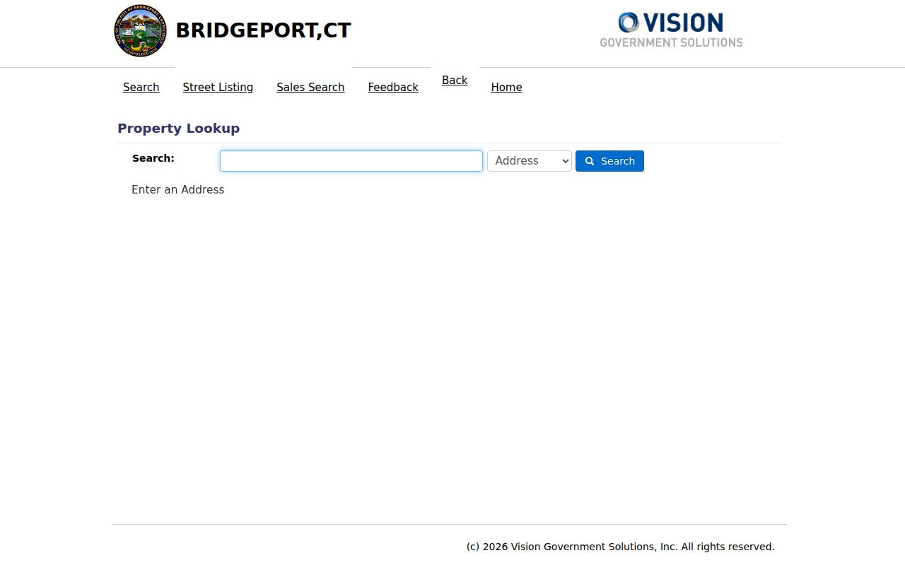
The search modes shown here make the street number a starting point. The resulting record still needs a source date and a cross-check in GIS or the Town Clerk index.
Search Vision for Bridgeport Street Addresses
Vision's address and owner modes are useful for a current street pass. The public portal also links to a Street Listing and Sales Search. Sales Search uses date, price, and neighborhood controls, but the inspected form did not expose a ZIP-wide search. That distinction matters: entering a ZIP is not the same as receiving an exhaustive list of Bridgeport parcels or residents.
| Search source | Choose Address, Owner, Acct#, Mblu, or PID. |
|---|---|
| Address or owner value | Enter the street clue or the record-owner name; the portal did not state a universal partial-match rule. |
| Account or PID | Use the account or parcel ID to refine a result and keep similar addresses apart. |
| Map and Map Cut | MBLU segments, with observed maximum lengths of seven and three characters. |
| Block and Block Cut | MBLU segments for the local block key; the inspected Block Cut field allowed up to seven characters. |
| Lot, Unit, Unit Cut | Additional MBLU pieces, with observed maximum lengths of seven, seven, and three characters. |
| Street Listing / Sales | Browse the street list or narrow sales by date, price, and neighborhood. |
Assessment cards can include owner, mailing address, land and building values, year built, stories, occupancy, sale fields, and other CAMA data. A mailing address may be in another town or belong to a business, trust, estate, or representative. Treat it as a record-owner clue, not proof of residence.
The Bridgeport Vision street listing is the browse route when the project starts with a named road and needs to be narrowed to individual cards.
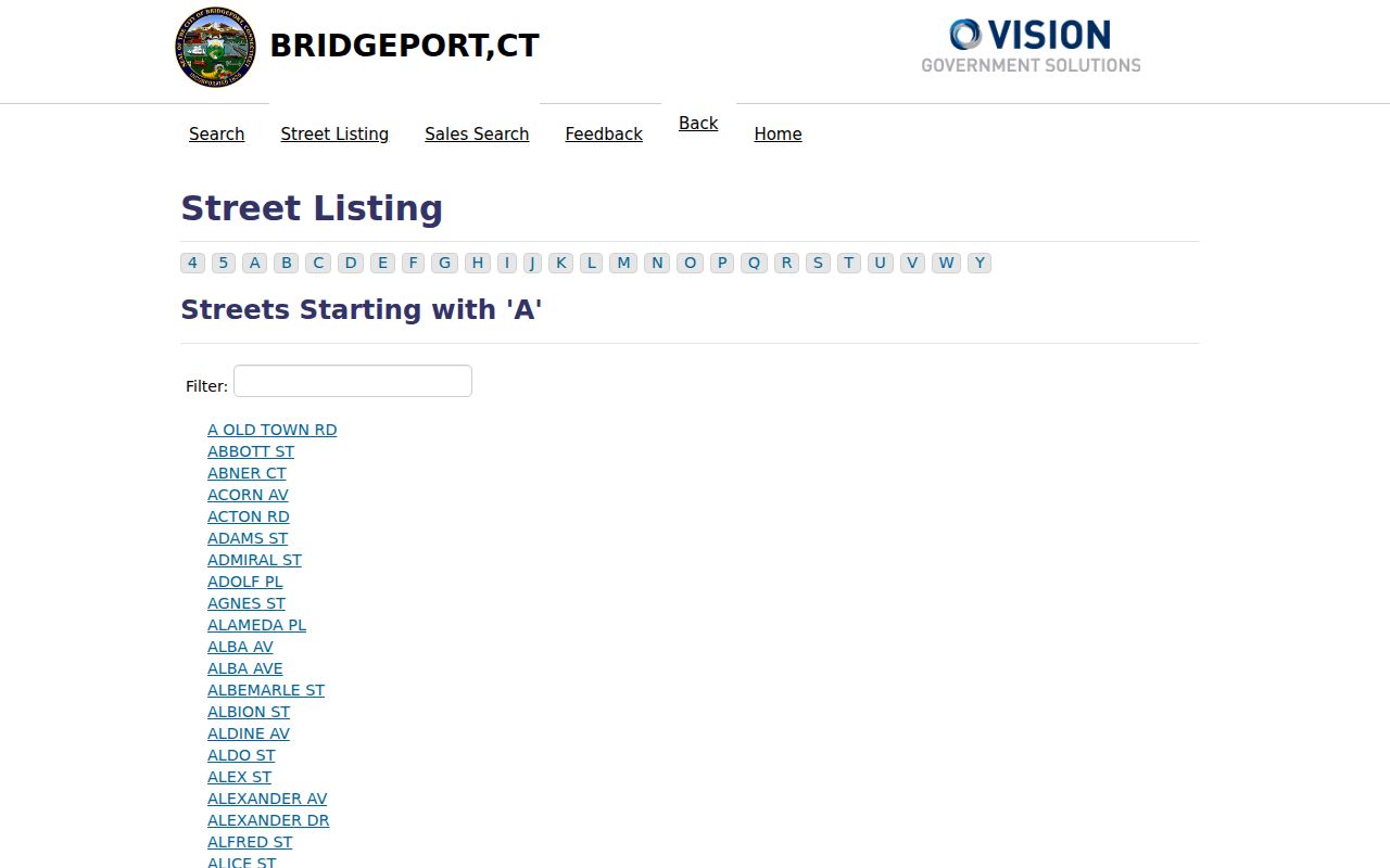
Street Listing helps define the spelling and address sequence before a researcher moves to a parcel, deed, permit, or historical source.
Bridgeport Records Searchable by Street
Address-keyed records do not all answer the same resident question. A complete street workflow places the sources side by side, then follows a stable identifier from one to the next. This is especially important in Bridgeport because the county label does not supply a current county clerk or recorder.
| Record set | Keeper | Street clue | Access |
|---|---|---|---|
| Vision Grand List | Bridgeport Assessor | Owner, situs, mailing address, PID, MBLU | Public portal |
| GIS parcel layer | City GIS and MetroCOG | Polygon, street number, parcel ID, adjacent lots | Map and REST query |
| Recorded land | Bridgeport Town Clerk | Owner converted to grantor/grantee and legal description | Free index; paid images/copies |
| Voter registration | SOTS and Bridgeport registrar | Named person and registration address | Individual lookup; no street browse |
| Building records | Building Department | Address, permit, applicant, owner, agent | Park City from 2021; FOI for searches |
| Historical street listings | Bridgeport History Center | Street number and printed occupant | Physical, microfilm, partial databases |
Start with the first two rows, then use the record owner or legal parcel to search the Town Clerk. Bring in the voter route only for a named question and the History Center only when a year or former occupant matters. That sequence protects the conclusion from becoming an unsupported claim about a whole household.
Browse a Bridgeport Street in GIS
The Bridgeport GIS Hub and MetroCOG service let a researcher see the street as parcels instead of a list of names. The parcel layer supplies polygon geometry, owner-linked fields, address, sale, assessment, land-use, zoning, neighborhood, building, and flood-related fields. The streetname layer supplies street name, address ranges, parity, prefixes, suffixes, and ZIPL or ZIPR values for the left and right sides.
In the viewer, locate the target street, select the parcel layer, and use Identify on each polygon. The REST service supports query, geometry and distance parameters, ordering, statistics, distinct values, export, Find, and KML. Its reported maximum record count is 5,000, so a long street or citywide request should be narrowed by street, geometry, or parcel IDs.
The Bridgeport parcel REST service is the source behind the map and exposes a real field model for research notes.
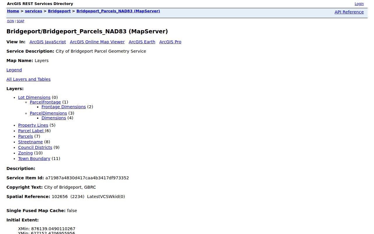
A GIS polygon can show which parcels touch a street segment, but it still must be joined to Vision or a recorded instrument before an owner statement is made.
Follow Deeds Along a Bridgeport Street
The Town Clerk's I2 index begins with party names, instruments, or dates. Use the current Vision owner and the parcel's legal identifiers to create the first name search. Run grantor and grantee roles when the direction is unclear. Relevant document labels include DEED, WARRANTY DEED, QUIT CLAIM DEED, MORTGAGE, LIEN, RELEASE, MAP, SUBDIVISION, PROBATE CERTIFICATE, and many local abbreviations.
Record the document number, book and page, recording date, parties, legal description, consideration when shown, and any prior reference. Then search the seller or predecessor in the earlier period. A mortgage is not a transfer, and a release is not a sale. When the chain reaches the I2 name-index cutoff of January 2, 1948, use the Town Clerk counter, older books, maps, certified copies, and State Library or archive help. The map series reaches September 23, 1835, which can bridge a street or lot even when a name index is not yet online.
The Bridgeport land-record page gives the current office route, written-request rule, and copy schedule. Keep the recorded date beside every owner change.
Bridgeport Address Permits and Records
Building records add a different kind of street evidence. The Park City Portal covers permits, plans, inspections, code cases, and requests or licenses from Building, Zoning, Health, and the Fire Marshal from January 1, 2021. An item may name an owner, authorized agent, contractor, architect, engineer, or inspector. That name is tied to an administrative transaction, not necessarily a current occupant.
For an older or complete property search, the Building Department says research is performed Wednesdays, not by phone or in person, through a FOI request. The stated minimum response estimate is 7-10 business days. Give the exact address, parcel ID if known, record category, and year range. The department also notes that plans and approvals can be part of the permit path and that delinquent taxes or WPCA sewer fees can affect issuance.
The Park City Portal is the current online starting point for address-based building activity.
The portal connects a street address to dated work records, while a FOI request is the documented fallback when the web interface does not answer the whole question.
The city's building record-search instructions explain the Wednesday-only search and FOI route.
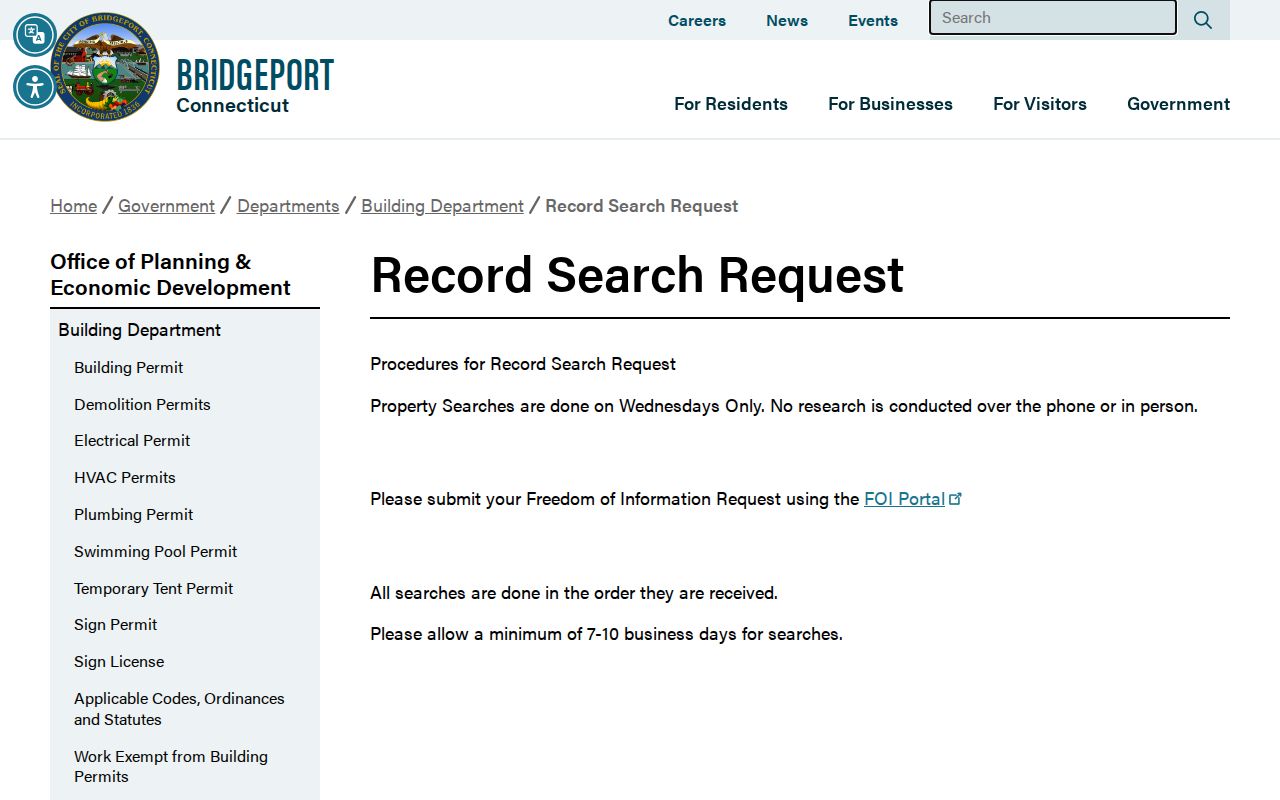
Use the request instructions with a narrow address and date range, and keep the response date with the permit history.
Bridgeport Street Names, ZIP Ranges, and History
Street names do not always remain simple search keys. Bridgeport documents show Ann Street in Steel Point renamed Bass Pro Drive in 2015 and Calhoun Street receiving the honorary name Val Esteves Way in 2018. A 2021 ordinance or minutes document describes the honorary naming program. No authoritative citywide street-renumbering project or single renumbering year was located, so the safe method is to test current and former names, nearby intersections, legal lot descriptions, and adjacent parcel owners.
The GIS streetname layer adds address ranges and ZIPL or ZIPR values, but ZIP codes are postal delivery layers, not city-limit or parcel boundaries. The official USPS address lookup should verify a particular number. Historical directories can use Bridgeport without a modern ZIP, and an older source may use a town or neighboring-place label after annexation. Keep the street spelling, number, municipal label, and source year in separate notes.
Read Historical Bridgeport Street Listings
The Bridgeport History Center's city directory run covers approximately 1855-1990. From 1895 onward, most volumes have an alphabetical section and a street section. The street section is the reverse-directory tool: read the number sequence, record each printed name, then move to the alphabetical pages for occupation, spouse or widow notation, telephone, and address variants.
A missing surname does not end the search. Try the street section, business pages, boarding entries, spouse or widow forms, initials, and adjacent numbers. Pair the printed year with a census year, newspaper notice, obituary, map, probate case, or deed. A directory can suggest that a household or business used a street, but it does not prove that every person at the address was listed or that the entry reflects the current day.
The History Center city-directory collection is the route for the specific volume, format, and year. Ask for the street section as well as the alphabetical section.
What a Bridgeport Street Directory Cannot Show
A street directory can connect an address to a record owner, parcel, legal instrument, permit, or historical listing. It cannot show every renter, family member, visitor, utility customer, delivery recipient, or unregistered person. The Connecticut individual voter lookup is not a public block browse. DMV address and title information is restricted by CGS §14-10 and the federal Driver's Privacy Protection Act. Police, court, vital, and Safe at Home records have separate limits.
Do not fill a gap by treating a mailing address as a home, an entity as an individual, or a no-match as evidence of absence. If the record may be protected, stop and use the custodian's correction or access route. If the goal is a past address, the Bridgeport city directory page explains the historical shelf without turning it into a current resident list.
Lawful use. Address and ownership records are for personal, lawful research such as genealogy, property history, or civic understanding. Do not use a Bridgeport street directory to stalk, harass, intimidate, or harm anyone.