
Bridgeport ZIP Codes and Their Delivery Uses
The Bridgeport ZIP code directory begins with a working coverage table, not a claim that every ZIP is a neighborhood polygon. The local area labels below come from USPS grouping material, GIS references, and Bridgeport research notes. They are navigation aids. USPS should decide the current delivery assignment for a particular address.
| ZIP | Areas or uses associated with Bridgeport | Delivery note | Boundary caution |
|---|---|---|---|
| 06601 | Downtown, business, institutional, and selected central addresses | Bridgeport grouping; may include special use | Not a city-limit polygon |
| 06602 | Downtown, central business, and PO-box or unique uses | Bridgeport grouping | Verify the street number |
| 06604 | Downtown, West Side/West End, and central addresses | Bridgeport delivery grouping | Historical tables group related ZIPs differently |
| 06605 | Black Rock, waterfront, West End, and nearby residential areas in common usage | Bridgeport-associated ZIP | Neighborhood label is approximate |
| 06606 | North End, Reservoir, and nearby northern areas in common usage | Bridgeport delivery grouping | Check current USPS assignment |
| 06607 | East Side, Mill Hill, and central-east areas in common usage | Bridgeport-associated delivery ZIP | Not a tax or ward boundary |
| 06608 | East End, Hollow, and nearby east-central areas in common usage | Bridgeport delivery grouping | Current grouping can differ from older tables |
| 06610 | Upper East Side and northern or eastern areas in common usage | Bridgeport delivery grouping | Confirm exact address |
| 06673 | Unique, PO-box, business, or special delivery grouping | Address-specific | Not a normal neighborhood area |
| 06699 | Unique, PO-box, business, or large-user grouping | Special delivery grouping | Use USPS for the current result |
A postal code can cross a municipal edge or use a preferred-place label that does not match a neighborhood. Start with the table to organize research, then use the official USPS ZIP lookup before treating any number as current for a street address.
Bridgeport ZIP Code Directory: Historical 06650
ZIP 06650 belongs in a Bridgeport history note, not in a current address assumption. USPS Postal Bulletin material documents deletion or reassignment in June 2017. Earlier DMM tables grouped 06601, 06602, 06650, 06673, and 06699 under a Bridgeport 06601 scheme, while later tables use different preferred-place and container groupings.
This is a postal-administration change, not evidence that Bridgeport annexed or lost a neighborhood. A historical directory may show Bridgeport without a ZIP, and a letterhead or business listing may retain an older special-use number. Save the source year and do not back-project a current ZIP into an 1855 or 1895 city directory.
The historical USPS DMM ZIP table is useful for comparison with the current lookup.
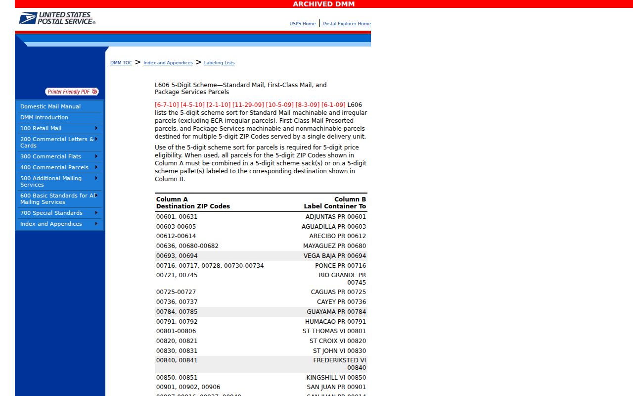
The historical table explains why a postal directory needs a date beside every grouping. Postal labels can shift without changing the underlying parcel.
Map Bridgeport ZIP Ranges in GIS
Bridgeport's official GIS streetname layer includes ZIPL and ZIPR fields for left and right address ranges, along with street name, prefix, type, postfix, parity, and from/to address values. Those ranges can help sort a ZIP-sized queue and join a street segment to parcel polygons. The parcel service also supports address and geometry queries, but the reported maximum record count is 5,000, so a broad request should be narrowed.
Use the streetname layer to find the range, then select parcel polygons and read ST_NUM, ST_NAME, LOCATION, Parcel_ID, GIS_ID, owner-linked fields, and MBLU. GIS is a map and data layer, not a USPS result and not a complete person list. A ZIPL or ZIPR value should be checked with the exact address because a range can span more than one local layer.
The Bridgeport GIS streetname layer documents the street-range route used for ZIP research.
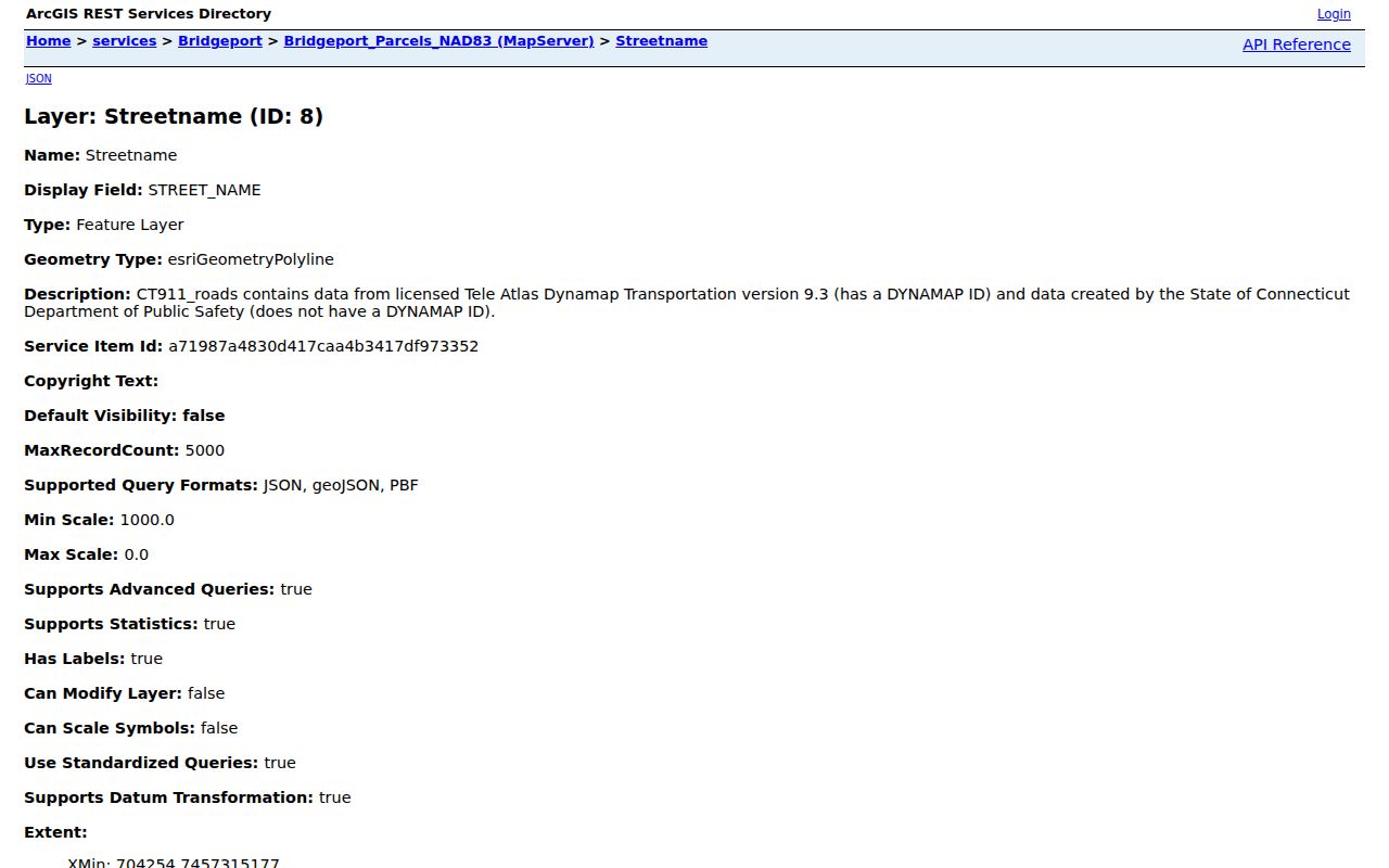
The map layer can narrow a research queue, while USPS remains the authority for a specific delivery address.
Verify a Bridgeport ZIP With USPS
The official USPS route has two modes. Find by Address returns a ZIP or ZIP+4 for a street address, city, and state. Find by City and State returns ZIPs associated with a place. The page was not reproducible in the unattended capture, so no current Bridgeport result or post-office assignment should be copied from a screenshot. The lookup is still the exact-address verification step.
| Find by Address | Choose the street-address mode for a corporate, residential, or unit-specific check. |
|---|---|
| Street address | Enter the exact USPS street form, including a unit or suite when needed. |
| City | Use Bridgeport or the preferred place shown for the mailing address. |
| State | Choose Connecticut or CT. |
| Find by City and State | Use this mode to see ZIP associations with a place, not to verify one parcel. |
| Search | Save the returned ZIP or ZIP+4 and the date of the result. |
USPS does not show owners or occupants. After the postal check, use GIS or Vision for the parcel, the Town Clerk for recorded instruments, and the History Center for an older address. A postal directory should never present USPS as a household directory.
The USPS address and city-state lookup is the official current check.
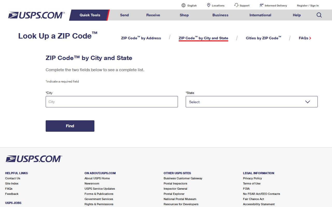
The lookup screen is the final postal check before a ZIP-specific address queue is treated as current.
Bridgeport ZIP Code Directory Versus City Limits
A postal code follows delivery administration. A city limit follows municipal geography. A neighborhood is a common local label. An NRZ plan follows a planning or community document. A council district follows an election map. These layers can overlap without matching. Bridgeport's Engage material describes 13 neighborhoods and 8 NRZs, while ZIP groupings divide the same city by postal use.
- ZIP code
- A USPS delivery grouping used to sort mail. It is not proof of a municipal boundary.
- ZIP+4
- An extended delivery code returned for a more exact address when USPS has the detail.
- PO-box or unique ZIP
- A special grouping for a box, business, large user, or other delivery purpose rather than a normal residential area.
- Carrier route
- A delivery route within the postal system, not a public list of the people served.
Check Bridgeport GIS Town Boundary and parcel layers when municipal location matters. Check USPS when mailing assignment matters. Do not use a neighborhood label to infer a parcel boundary or use a ZIP to infer voter, owner, or occupancy status.
Bridgeport Parcel Search by ZIP
Vision's inspected Search and Sales modes do not expose a ZIP-wide resident directory. Use the ZIP to organize street segments, then search each exact address or owner. The Sales Search offers date, price, and neighborhood filters. The address search accepts Address, Owner, Acct#, MBLU, and PID. The GIS streetname layer can help produce the range, but the assessor card remains parcel-specific.
For each address, save the situs, owner, mailing address, parcel ID, GIS ID, MBLU, assessment year, sale date, and any field-card link. Compare the city boundary and USPS result before moving to the Town Clerk or a historical directory. The postal number is a queue key, not a replacement for a legal description.
The Vision Sales Search shows the date, price, and neighborhood filters that can support a ZIP-adjacent property review.
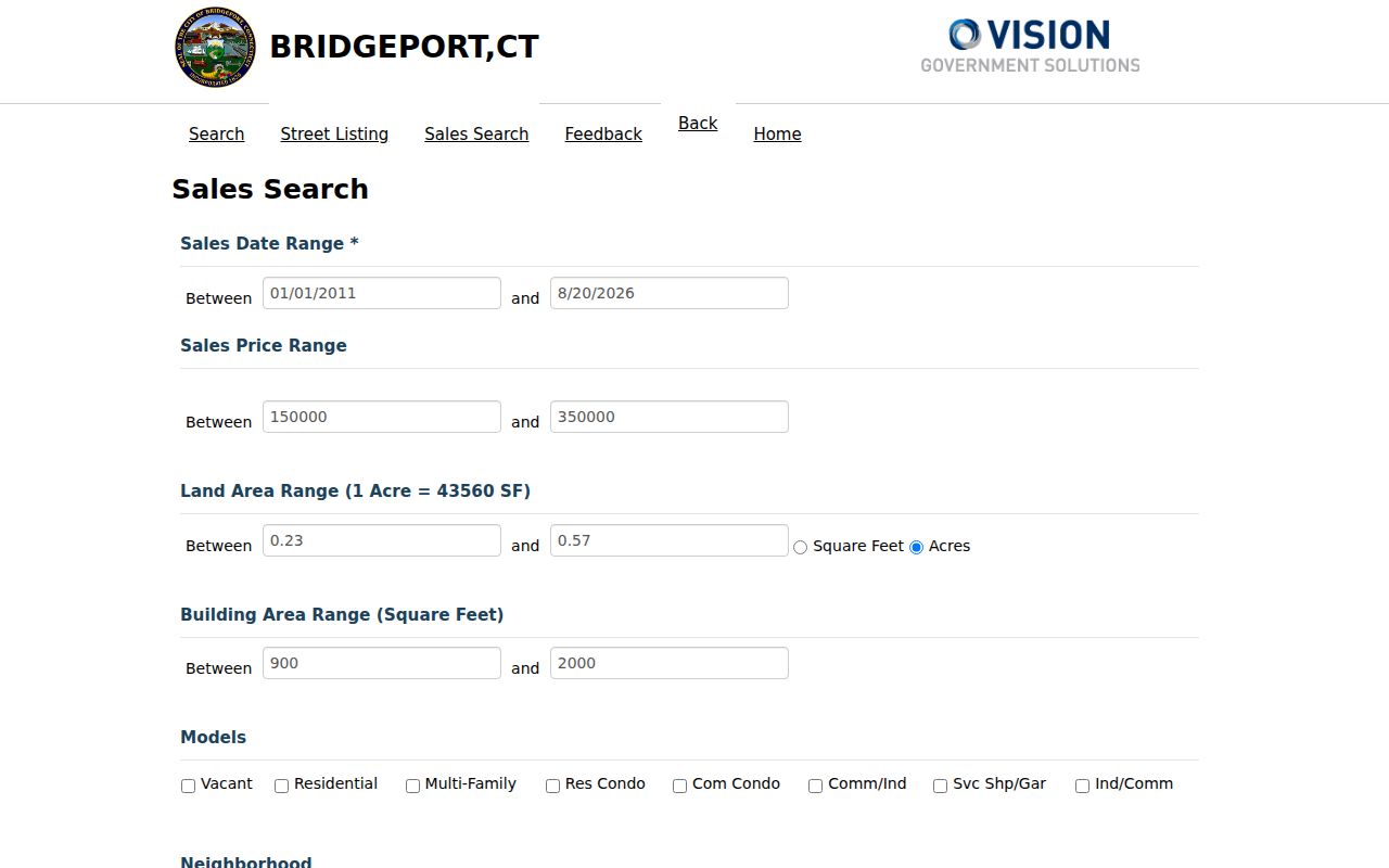
Sales filters can add a dated property angle, but they do not turn the portal into a complete ZIP code directory of residents.
Find Bridgeport Residents by ZIP
The ZIP-keyed workflow is a sorting method. It does not promise that every person in the delivery area will appear. Begin with the ZIP and a precise research question, then narrow to addresses and source roles.
- Confirm the ZIP and preferred place with USPS for each exact address or use the city-state mode for a working set.
- Compare the address with Bridgeport GIS street ranges, ZIPL or ZIPR, parcel geometry, and Town Boundary layers.
- Search Vision by address and retain the owner, mailing, situs, PID, GIS ID, and MBLU fields.
- Use the Town Clerk index for a recorded owner or instrument, and use the state voter lookup only for a named registration question.
- For historical work, read the History Center street section and maps without assigning a modern ZIP to an old volume.
Once the ZIP has narrowed the list to a street, continue with the Bridgeport street directory process. If the goal is one person, switch to the Bridgeport resident lookup workflow rather than building an unsupported street roster.
Neighborhoods and Bridgeport ZIPs Overlap
Common local routing often places Black Rock and parts of the West End near 06605, North End and Reservoir near 06606, East Side and Mill Hill near 06607, East End and Hollow near 06608, Upper East Side and eastern areas near 06610, and central or Downtown areas near 06601, 06602, or 06604. These descriptions are approximate. They are useful for finding a plan or archive, not for deciding a particular address.
NRZ plans, council maps, GIS boundaries, and USPS delivery areas are separate documents. Bridgeport's research also notes that historical preferred-place tables grouped ZIPs differently and that 06650 was deleted or reassigned. Preserve those changes in a dated note. A ZIP code directory is more useful when it tells a reader which layer to verify next.
Build a Bridgeport ZIP Research Queue
For a ZIP-wide project, make a small table with the postal result date, street, number, unit, preferred place, municipal layer, parcel ID, owner source, and historical source. Query the GIS range in manageable pieces because the parcel service has a 5,000-record limit. Do not merge a current Vision card with an old directory line into one undated resident entry.
The safest order is USPS, GIS, Vision, Town Clerk, then library or archive. If a record is not online, a precise FOI or custodian request can name the ZIP, address range, date, and record category. Building searches have a 7-10-business-day minimum through the documented FOI route. Historical directories and maps may require a History Center visit or a specific reel request.
ZIP reminder. A Bridgeport postal number helps sort addresses. It does not establish city limits, ownership, voter status, or who lives at a property.